Moore Ravine - David Balfour Park Loop
It's hard to believe that there are ravines like this in the middle of Toronto. Surprisingly, it took me so long to blog about this route.


Suggested Route
I parked at the Rosehill lot and began a 10 km hike at the David A. Balfour Park entry point on Avoca Ave. Walking south, follow the trail to the left to Evergreen Brickworks. Join the Beltline trail that takes you through the Moore Ravine to the Mount Pleasant Cemetery. Join the trail back into the ravine along Yellow Creek to the access point to the David A. Balfour park near the parking garage. This garage is near the St. Clair Subway Station.

Off-Leash Opportunities
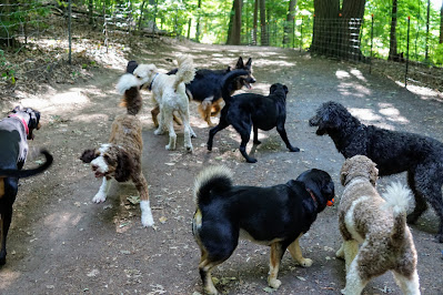
There is no official off-leash area for most of this hike. I took Lucy to the Evergreen Brickworks Off-Leash Park as part of the hike to play free. If you find an area that isn't busy and your dog is trained to stay with you, there are opportunities. The west side of the trail near Yellow Creek has nearly no cyclists and easy access to the water. The Moore Ravine side is crowded and is often patrolled for off-leash dogs.
Heath Street
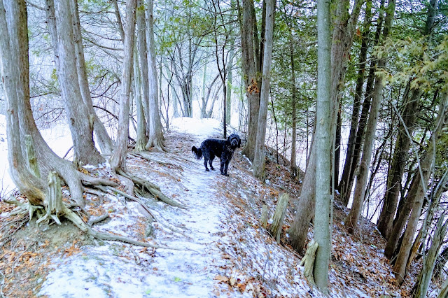
You can enter the ravine from Heath Street East. The street ends at the Nature Trail sign.


The area next to the creek has a few areas that may be safe for dogs to run off-leash.

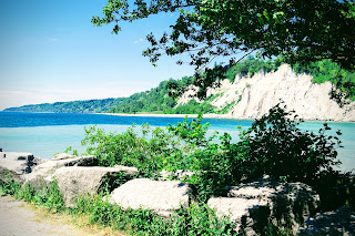
We found a painted face in the part of the creek that is under construction. It remains to be seen if the large concrete pieces survive the construction.

Yellow leaves completely cover the ravine in November with bright red burning bushes in just a few places to make a beautiful landscape.

There are trails on both sides of the creek and at different levels of the surrounding hills.

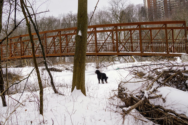
Use the bridge to cross to the other side of the creek to make a short loop.

The trails along the hill are lined with railings for safety.

There is just enough room on the trails for dogs to meet and play.

Past the railroad trestle, the creek ends, and the trail gets wider and goes through a forest.

Cross Mount Pleasant Road at Roxborough Drive and stay on the trail that goes through Park Drive Reservation Lands.


Just past a maintenance building, the trail splits again. Both trails take you to Evergreen Brickworks. The trail on the right takes you to an entrance of the Evergreen Offleash Dog Park. The trail on the left takes you up a hill and passes the dog park.
Evergreen Brickworks
You can either walk right through the Evergreen Brickworks to continue your hike. If you wish to stay and explore, see our blog entry about this area.
Beltline Trail
The trail through the Moore Ravine is also known as the Ravine Beltline Trail and is part of the Kay Gardner Beltline Trail. This trail is very heavily used by cyclists, joggers, and pedestrians of all kinds. It is essential to keep your dog on a leash through this area as it is often patrolled.

Mud Creek is deep in the ravine and is far enough from the trail that dogs can play in the water to cool off.


At this point, you can cross the bridge to walk along Heath Street back to where you parked or cross Moore Ave to enter the Mount Pleasant Cemetery.

Parking
For free parking, the best I can suggest is local street parking. These can fill up fast, so come early and be sure they allow parking for longer than one hour at a time. Look for spots around Moorevale Park and the surrounding streets. Consider parking in an official lot. My suggestion is the Rosehill Parking Garage, which has a $5 maximum on Sundays. The hike takes you through Evergreen Brickworks, so parking there is an option as well.Route Alterations
There are many ways to shorten this hike while still making a loop. The most common one is to loop around Yellow Creek for a 3 km hike in the ravine.
You could use the Cat's Eye Bridge and walk along Heath Street to make it a 7.5 km hike.
To lengthen the hike, join up with one of the routes previously blogged about:
Todmorden Mills to Chesterhill Lookout
Crothers Woods, Lower Don, Evergreen Brickworks


Comments
Post a Comment