Posts

Showing posts from November, 2020

Torrance Barrens Conservation Reserve

Image
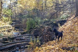
Hiking Muskoka In October, we spent two weeks hiking trails in the Muskoka region. This entry is part of that series. Torrance Barrens is a great trail that was recommended to us by local hikers. On a Sunday morning in October, the parking lot was completely filled, so this is a well-known trail. Even with a full parking lot, we rarely encountered other people on the trail. The area is extensive and people walk the trails at different speeds. Parking The official parking lot is on Southwood Road, Gravenhurst .  Portable toilets can be found at this location. We noticed cars parked on other sections of the road, so there are many access points.  One of the first things I noticed about this trail is the secondary name "Dark Sky Reserve." A sign at the trailhead gives more information. For the past year, I've been working with the Space Place Canada team to bring a planetarium to Toronto. One of the things that Toronto is short of is a dark sky. The Torrance Barrens Dark Sky

Cooper's Falls Trail near Gravenhurst

Image
Hiking Muskoka When we're able, we use our talents as hikers in Toronto to explore other parts of Ontario. This entry is one of the series from our October visit to Muskoka.  Cooper's Falls Trail is a 7.3 hike each way and is located near Gravenhurst with beautiful lakes and the Canadian Sheild landscape.  The Cooper's Falls Trail is part of the Trans Canada Trail that spans 27,000 km across Canada. There are no waterfalls on this trail, instead expect typical Canadian shield terrain and marshy ponds. Expect to climb over large rocks that are typical in this part of Ontario. The trail is mostly well marked with blue signs. We had some trouble finding the trail past Larroger Road. Parts of the trail are very muddy so wear appropriate footwear.  The leaves were still colourful during our hike, which made the scenery spectacular. We turned around halfway but met several hikers who trekked both ways. Parking There are parking lots at each end:  Housey's Rapids Road  Cooper

Moore Ravine - David Balfour Park Loop

Image
It's hard to believe that there are ravines like this in the middle of Toronto. Surprisingly, it took me so long to blog about this route.  The hike encircles the Rosedale and Moore Park neighbourhoods with Yellow Creek on the west and Mud Creek on the east. My delay in blogging about this hike is two-fold. There is ongoing construction in the Rosehill Reservoir and David A. Balfour park affecting the trail on the west side. Hikers can still use most of the trail, but some of the access points are closed. Secondly, if you don't live within walking distance or use transit, there are very few free parking spots. Suggested Route I parked at the Rosehill lot and began a 10 km hike at the David A. Balfour Park entry point on Avoca Ave. Walking south, follow the trail to the left to Evergreen Brickworks. Join the Beltline trail that takes you through the Moore Ravine to the Mount Pleasant Cemetery. Join the trail back into the ravine along Yellow Creek to the access point to the Davi

Rouge Beach to Petticoat Creek Conservation Area

Image
Rouge Beach is located at the mouth of the Rouge River and is part of the Rouge Urban National Park. The trails are not connected because of the large marsh area just before Lake Ontario. Rouge Beach is popular for fishing, beach play, and canoeing. Hiking is done along the Waterfront Trail. Read our earlier blog entry about a hike from the Highland Creek Water Treatment Plant to Rouge Beach.  This blog entry goes east along the lakeshore through Petticoat Creek Conservation Area.  Parking There is plenty of parking at the intersection of Rouge Hill Drive and Lawrence Ave East .  Suggested Route The route we took was 7 km in length, as we explored in the Petticoat Coat Conservation Area. Future posts will cover more of the area. Rouge Beach From the parking lot, walk on the boardwalk next to the marsh.  The marsh is beautiful even after most of the leaves have fallen. There is damage to the trees, so there are beaver in the area, but we didn't see any. With a marsh, there are oppor