The Humber River is 100 km long, so there are many hiking trails to explore.
The river connects to Lake Ontario in the south. See earlier blog entry, Sunnyside Beach, about a park to explore at the southern point of the Humber River.
Parking or Transit
This hike begins at the Etienne Brule Park, where there is free parking. For those who use transit, the nearest subway station is the Old Mill Station. You'll be following part of the Humber River Recreational Trail.
Suggested Route
Starting at Etienne Brule Park, walk north on the paved path until you reach the footbridge over the Humber River. Turn back at this point for an 8.5 km hike.
The Trail
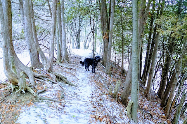
You can walk the paved trail for the entire hike if you like. There is also a gravel path as well as a footpath next to the river. Cyclists tend to use the paved path and joggers the gravel path.
I like to use the river path to get the best view of the birds, and for Lucy to play in the river.
Weir or Low Head Dams
The barrier that runs across the width of the Humber River is called a weir. These low head dams alter the flow of water, and there are several in the Humber River. In the autumn, salmon migrate upriver to spawn and face the challenge of jumping the weirs. This has become a spectator sport in Toronto, with people cheering as the salmon make their jumps. Follow our Instagram account to find out when this is happening.
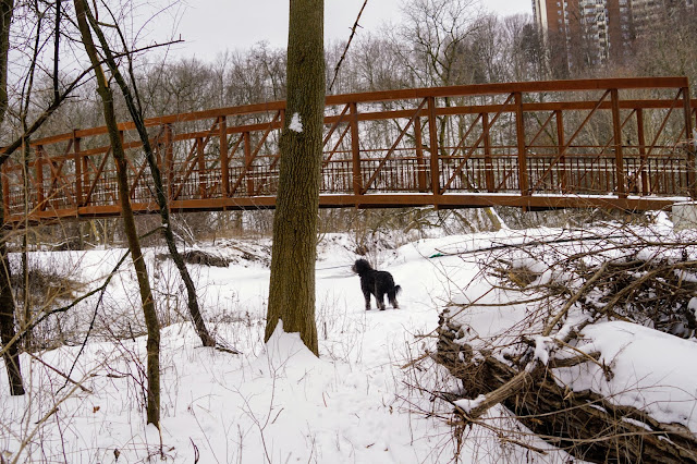
Footbridge
About 4 km from the start of the trail, you'll come to a footbridge that crosses the Humber River. Enjoy the view from the bridge in the middle of the river.
I was hoping to find a trail going south along the west side of the Humber River after crossing the footbridge, but there doesn't seem to be one that starts at this point. There is a trail going north on the west side of the river, but not south.
Birdwatching
The Humber River was never as industrialized as other rivers in Toronto, so parkland, and therefore wildlife, is abundant. Fishing is a popular activity on the river for both humans and waterbirds.
 |
Egret
|
 |
Cardinal
|
 |
Red-Tail Hawk
|
 |
Cormorant
|
Wildlife
The only wildlife we saw on our hike was a raccoon. This is not good as raccoon shouldn't be out during the day, and this one wasn't the least bit afraid of the humans or dogs passing by.
There are likely deer, coyote, foxes, rabbits, groundhogs, and other animals in the park.
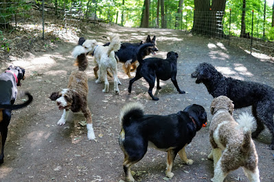
Friends
We met plenty of other dogs on our walk. As usual, instant friendships were formed regardless of the breed, colour, or size.
Most of the play was done while leashed.
We let the dogs run off-leash for a bit in the large grassy areas alongside the trail.
I was able to keep Lucy off-leash while we walked on the river path as it was separated from the pedestrian and cycling traffic.
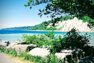
Scenery
Natural scenery such as wildflowers, cliffs, and unusual trees can be seen while on this hike.
 |
Purple Aster
|
Creative people have been busy making scenery in the form of rock cairns and painting concrete.
History
Do you ever try to imagine what the world looked like to the first people to inhabit these lands? The Humber River was a significant waterway to the first people to inhabit the region. Read this description that I found on the toronto.ca website:
Etienne Brule park is a historically significant piece of land. It was named after Etienne Brule, the first French explorer to venture beyond the St. Lawrence River into Upper Canada (Ontario). The Humber River and its shores along Etienne Brule park were once used as a major trade route by the Aboriginal Peoples of the area. It is a beautiful park stretched out along the Humber River starting near the Old Mill and winding north to the bend in the River around the Baby Point neighbourhood.
Trail Extensions
If you would like to make your hike longer, you can cross the river via the Dundas Street Bridge and walk the west side of the river before returning to your starting point.
As mentioned earlier, there are many trails along the Humber River, so stay tuned for more blogs about hiking opportunities.
Instagram
Enjoy your hike! When you post photos to Instagram, tag us at @hikingtoronto or #hikingtorontowithlucy.


This comment has been removed by a blog administrator.
ReplyDelete