Mast Trail in Rouge National Urban Park
The Mast Trail is a popular hike in the Rouge National Urban Park between the Little Rouge River and Rouge River. Hike a 5 km loop that begins near Kingston Road through the hills to the Twyn Rivers trail head.

The Mast Trail is an intermediate-level hiking trail. Some of the hills are steep, and it is pretty easy to get off the official path, so perhaps it can be considered an advanced-level hike. You won't get lost if you leave the official trail, but you may end up walking further than you anticipated.
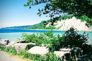
Read my blog about the Vista Trail, which is likely the easiest trail in Rouge Urban Park.
Parking
The Glen Rouge Campground is still closed due to the pandemic, but the parking lot is open for day-hikers.

This is a popular place for people to hike, especially on weekends. If you find a full parking lot, drive to the Twyn Rivers Drive parking lot and start your hike there.
Suggested Route
The official trail is marked by blazes that are painted on trees.

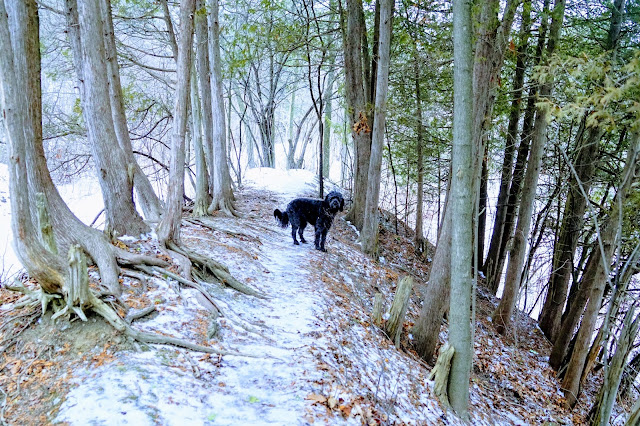
The Trail
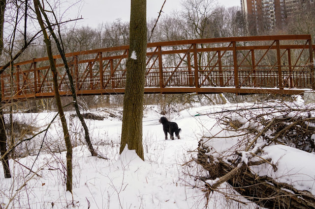
After parking, cross the bridge over the river. You can go left or right. Both trails take you to the same place.

I like to go to the right as this part of the trail is less travelled and goes through fields of wildflowers and ferns.

Yellow irises grow on the banks of the river.

The sandbanks in the river are a great place to let your dog off-leash.

It's on this sandbank that I've seen Great Blue Heron. I've seen many of them this summer, but it never gets old. They are beautiful birds to see.

Follow the trail up the hill, and you'll be treated to vista views of the river.

The forest is thick, so you can beat the heat, and if few people are around, let your dogs off-leash to chase squirrels.

I don't usually see birds this deep in the forest, but on one recent hike, we followed a blue jay until we got a photo.

The trees are painted with blazes to show you the route. This one says to continue straight, up the stairs.

The recommended route is marked by these blazes. You need to pay attention because they are easily missed. There are many well-travelled trails that you might accidentally follow. If you do, you'll lose the main trail.
At the top of the stairs, we found an extensive collection of "Rona 2020" painted rocks.

A double blaze with the left one higher than the right means you should veer to the left to stay on the main trail.

Meadow
About 2 km into the walk, you'll reach the meadow and then the river. Across the river is the Twyn Rivers Parking Lot.

Turn left and follow the path along the river until you see a tree with double blazes that look like an equal sign. This means you've come to the end of the Mast Trail, so you have a few choices.

Twyn Rivers Trail Head
At this point, you could turn around and retrace your steps back to your car. The trees are marked with blazes all the way back to where you came from.
If you cross the road, you will be at one end of the Vista Trail. See my blog entry about the Vista Trail.
My recommendation is to turn left and follow the path up the hill. This will take you back to your starting point but on unmarked trails. It's easier to follow these unmarked trails without getting lost, so why not give it a try.

The Route Back
From the meadow, you likely noticed a very steep hill with trails. You'll now be at the top of that hill. I've seen people run up this hill for training, and in the winter, it's a popular spot for tobogganing.

We found a large stone and made this our rest stop for the hike.

Follow the trails, and when you get to the top of a fairly steep hill, you'll be back on the main trail.

You'll see a broken orange fence and a sign for the Mast Trail. Continue on the trail to the right and follow the blazes back to your starting point.

Exploring
As mentioned earlier, there are many different trails in this part of the park. I've explored many of the trails and have seen some unusual things. I can't direct you to these location, but encourage you to take the time to explore the area to see if you can find them.

Urban Art

Outdoor Living Room

Mushrooms or some kind of tree growth.
Enjoy your hike! When you post photos to Instagram, tag us at @hikingtoronto or #hikingtorontowithlucy.


ssasasa
ReplyDeleteAs it has helped me lots and I'm sure that it's going to do the same for you! click
ReplyDeleteTheir skilled team is responsive and helpful. best branding company
ReplyDelete